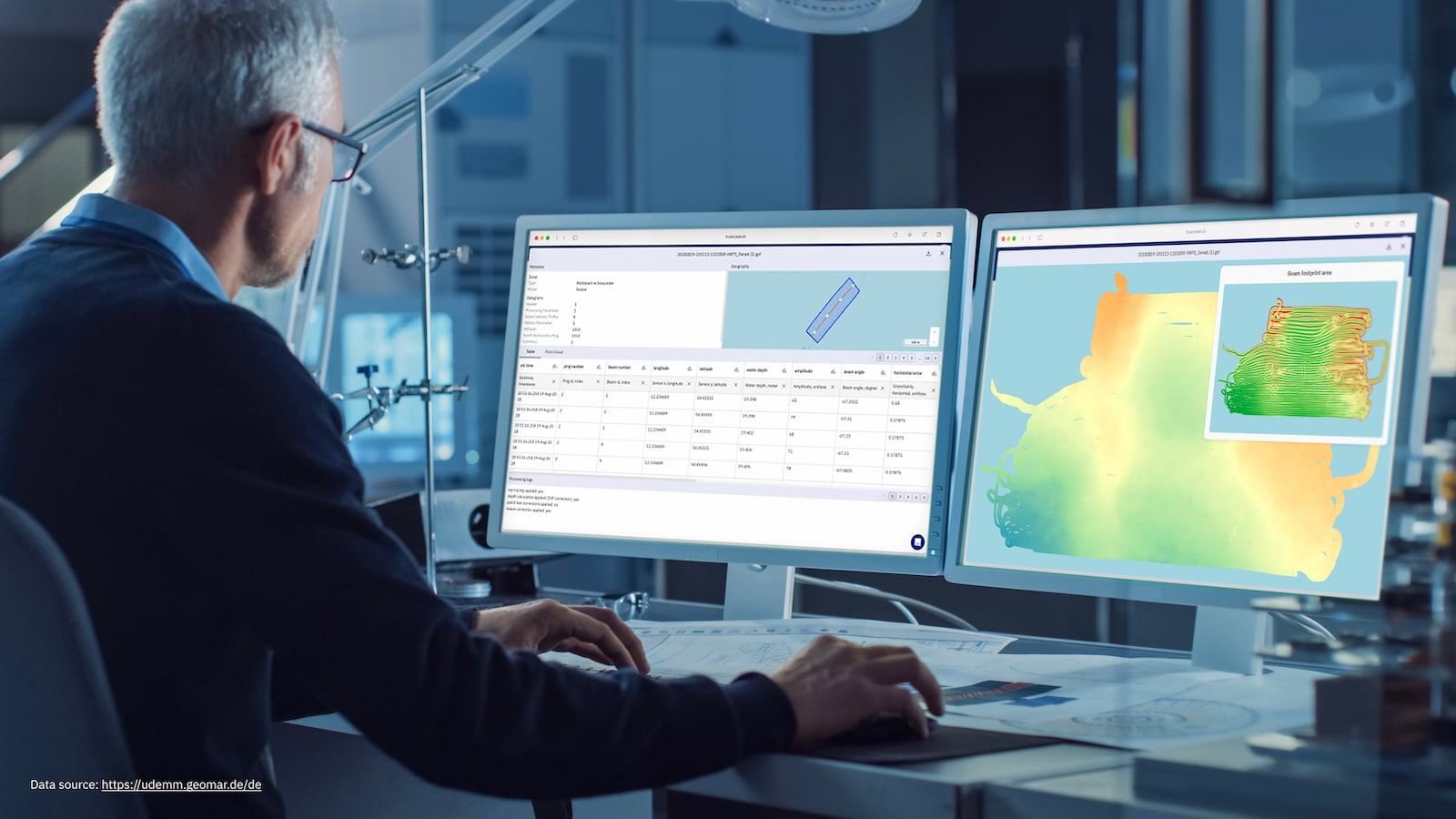
The Changing World of Geoscientists and Ocean Data
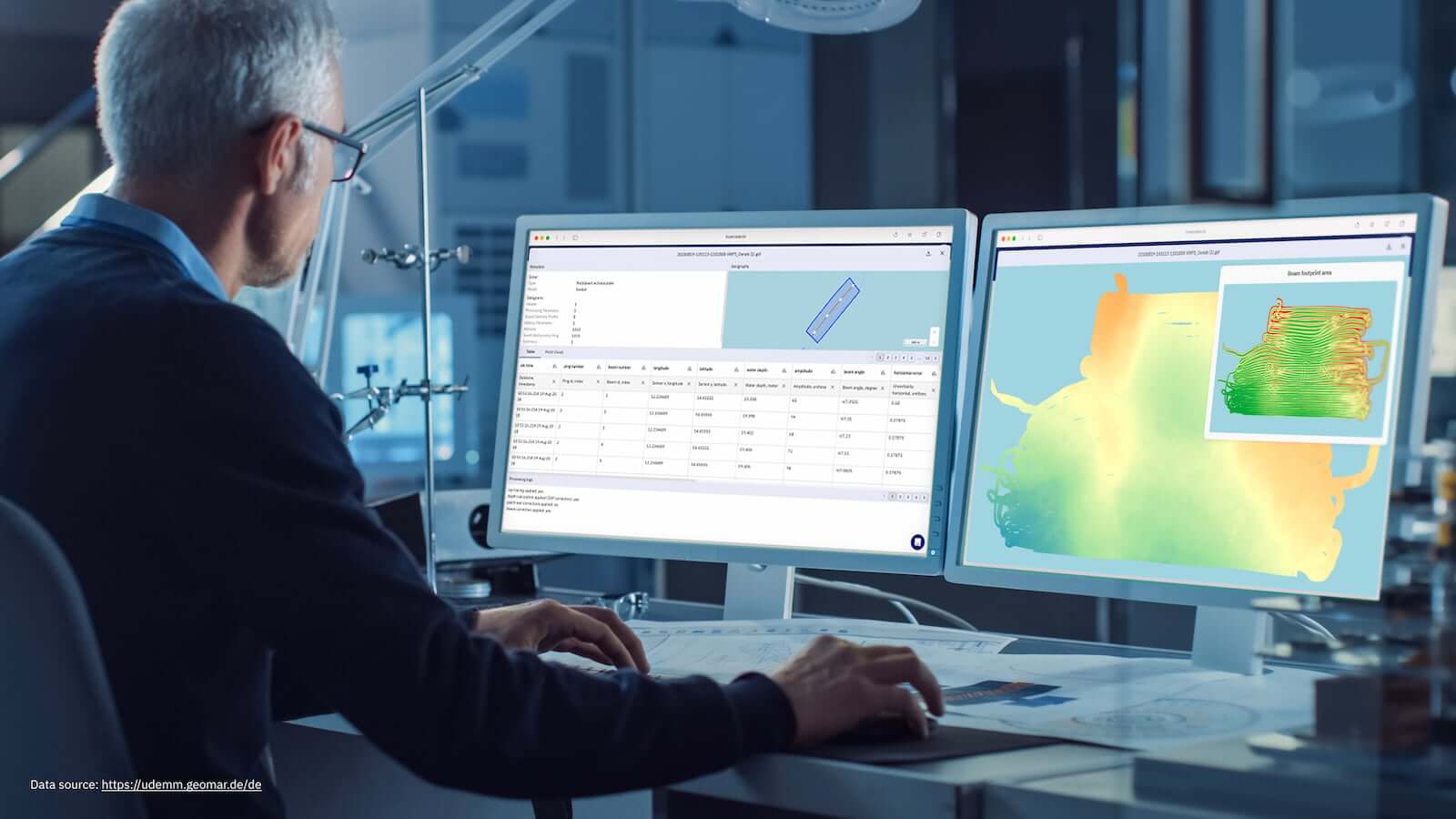
“The energy transition is going to need geoscientists. Almost every kind of renewable energy or net zero initiative you can think of relies on geoscientists in some way... really, everything that you can think of in terms of our future energy security going forward to renewables needs geoscientists. It's quite scary when you write it all down,” says Rebecca Bell, a geologist and Associate Professor in the Tectonics Department of Earth Science & Engineering at Imperial College London.
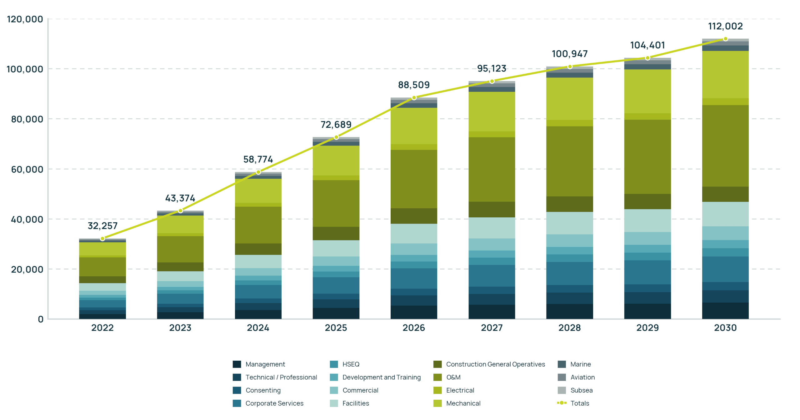
As geopolitical challenges and financial uncertainties in the offshore and subsea industry rise, a parallel growing challenge with a global offshore workforce shortage is escalating. A study from PricewaterhouseCoopers reports that the UK alone already faces a gap of 200,000 qualified workers to deliver on its climate and decarbonization goals (Williams, 2025).
The problem lies not just in dwindling numbers of available staff but in the changing skillset, especially from oil & gas to renewables. Project volumes grow, complexity rises, way of working is changing, margins become narrower, and data pressure is exponentially growing. With this shift towards ocean big data, technologies that allow handling large-scale ocean data become essential to ensure project delivery and success.
Source: (Offshore Wind Industry Council, 2023, p. 9)
north.io sat down with geologist Rebecca Bell to discuss the evolution of geoscience and the growing challenges the Offshore industry is facing.
“A big evolution has been the rise of data science, the importance of programming, and now, of course, machine learning and AI. It used to be quite rare for geoscientists to be able to code, and now it’s becoming the norm and a major advantage for those people." Rebecca said.
Geoscience Across the Value Chain
Fragmented and often tedious workflows persist across offshore stakeholders, including asset owners, OEMs, surveyors, and EPCI contractors. Throughout the data value chain, information stays siloed, which further limits interoperability between data and processes. As a result, collaboration between key actors, such as developers, surveyors, engineers, and regulatory authorities, becomes inefficient, slowing down decision-making as well as project progress.

Figure: based on Wang et al. (2025)
Subsurface data is a critical business asset across the entire offshore operations lifecycle. As part of the identify and assess phase, geoscientific data constitute a critical foundation for estimating the potential capital expenditures (CAPEX) associated with many work packages, like foundation, transport & installation, and inner array cable. Early availability of site‑specific information is essential for evaluating the overall technical feasibility of a given opportunity and for assessing subsurface‑related development risks in a robust and reliable manner. During design and planning, it informs site selection, ground conditions, and engineering feasibility, reducing uncertainty before major capital is committed. In construction and installation, accurate seabed and subsurface data enable safe foundation placement, cable routing, and installation planning, helping avoid costly delays and rework. Throughout operations and maintenance, survey data supports asset integrity monitoring, scour detection, and infrastructure inspection, minimizing downtime and operational risk. Finally, in decommissioning, reliable historical and current seabed data ensure safe removal planning, regulatory compliance, and cost-efficient site restoration.
As the energy transition accelerates, each area of the value chain sees increasing demand for skilled workers. This is especially true not only for construction and installation but also for the operation and maintenance segment, which must manage the entire cumulative installed capacity, which is forecasted to grow over time. Creating technical demand in the operation and maintenance segment from a previous 116,013 in 2022 to a projected 277,209 in 2030, further widening the workforce gap based on a report from the Wind Energy Council.
Challenges in the New “Data World” of Geoscience
GIS and geophysics (survey) departments regularly manage extremely large data packages, often several terabytes consisting of tens of thousands of individual files, while design and engineering teams depend on near real-time access to this information to keep projects on track (e.g., design engineering, daily reports comparing the “as built” construction progress with the design regulations). The lack of a centralized system for managing and validating this data creates significant operational overhead and increases the risk of missing data in any decision-making process.
- Massive data volumes: Survey deliveries often contain multiple terabytes of data and thousands of individual files that must be processed and shared across teams.
- Operational overhead: In the absence of a sole source of truth, data managers spend approximately 2–3 hours per day searching, downloading, and uploading datasets across different portals and systems.
- Limited quality assurance: Due to the high workload and lack of software that enables automated and visual QA, many files cannot be thoroughly checked.
- Accumulated project risk: Missing or insufficient QA can allow data errors to propagate through the project lifecycle, potentially leading to financial risks of up to €100 million.
Frictionless and automated processes are key to release pressure from expert departments working on subsea surveys, data processing, data management, and engineering. With recent budget cuts, geophysical and geotechnical departments are particularly faced with a shortage of skilled staff and outdated non-scalable desktop solutions. These automations can empower geoscientists and engineers by streamlining repetitive tasks, improving scalability, and allowing experts to focus on higher-value analysis and decision-making. Rebecca adds,
“AI and automation have lots to offer the industry where time is money more so than it is in academia and research. I just caution, it's not a magic wand, and it really requires people who can harness and correctly interpret it.”
How north.io’s Ocean Data Platform Supports the Industry and Workforce
Rebecca shared her experience working recently with people in the offshore industry and was surprised to see how many different software programs they use to analyse and view their diverse types of data.
“There's a different software for seismic, multibeam echo sounder, side scan sonar, and different software for geotechnical data. And it gets very complicated to manage these huge files in all these different places.”
The Ocean Data Platform by north.io provides a centralized environment for managing large-scale offshore survey data while improving collaboration between survey teams, data managers, and engineering departments. By automating repetitive data handling tasks and enabling efficient quality control, the data platform reduces operational overhead and allows expert teams to focus on interpreting and using the data rather than managing it.
- Single Source of Truth: One centralized platform to collect, manage, and audit large-scale offshore data, including both legacy datasets and incoming survey deliveries, ensuring consistent and reliable access across teams.
- Reduced Data Management Overhead: Smart tools and geospatial intelligence automate many manual data handling tasks, significantly reducing operational workload and giving expert teams more time to focus on what matters most: data interpretation and decision-making.
- Automated QA and Visual Inspection: The platform enables subject matter experts to inspect a wide range of subsea data formats while performing automated quality assurance checks, such as resolution validation, point cloud density checks, and metadata standard compliance.
- Near Real-Time Progress Reporting and Data Sharing: Survey contractors can share data directly through the platform, enabling near real-time progress monitoring. This supports remote project oversight, reduces the need for client representatives offshore, and helps lower project costs and HSE risk.
Changing Offshore and Subsea Realities on the horizon
The offshore industry is not just approaching a pivotal shift; it’s already in the centre of it. As expertise evolves from isolated subject-matter geoscience specialists toward trained interdisciplinary geoscience experts with big data capabilities, innovative technologies pave the way to make ocean big data manageable at scale. The entire sector is beginning to unlock new possibilities for data-driven offshore operations. Envision an offshore world where ocean data is continuously ingested, processing and analysis pipelines run automatically, financial and security risks are detected before they escalate, cross-departmental decision-making is supported by near real-time insights, and experts focus on judgement and decision-making, not data handling. We are at the tipping point to make this vision an operational reality.
If you would like to share your current ocean big data challenges and the opportunities you see within the offshore industry, feel free to reach out for a demo today.
We thank Rebecca Bell for offering her insights and knowledge for this article. She is an associate professor at Imperial College London, helping to train a new generation of geoscientists. For those interested in getting into the field and looking for educational opportunities, please check out the Renewable Energy with AI and Data Science: Geology and Geophysics (READY) MSc at Imperial College London.
References
- north.io (2024) > Click here to open reference
- Wang, H., Savage, R., Zhao, F., & Madan, K. (2025). Global wind workforce outlook 2025-2030. In Global wind safety. Global Wind Organisation. > Click here to open reference
- Williams, L. (2025, September 23). Data geologists are key to making the energy transition work. Bloomberg. > Click here to open reference