Centralise your ocean data workflows through our platform: focusing on data sharing, quality control and collaboration.
Combining the worlds of geospatial (GIS) and geophysical.
The Challenge
The Challenge of Managing Ocean Big Data
Today’s offshore projects are slowed down by broken data workflows and disconnected tools:
Fragmented Data Landscape
Data is scattered across local servers, hard drives, and departments, with no single source of truth.
Slow, Manual
Data Transfer
From vessel to office to final deliverable, it simply takes too long to access, review, and deliver data products.
Too Many Formats, Too Many Tools
Dozens of incompatible file types and missing standards require switching between multiple software suites, causing inefficiency and data loss.
Difficult to
Visualize & Share
Complex 2D/3D underwater data is hard to interpret and nearly impossible to share seamlessly across internal teams and external partners.
Our Solution
How We Fix the Ocean Big Data Landscape
Our platform provides structure, accessibility, and clarity to your ocean data operations, turning complexity into insight.
Scalable Storage Solution
Secure, cloud-agnostic infrastructure that grows with your project: no more scattered hard drives or expensive local servers.
40+ Supported File Types
Work seamlessly across survey, geophysical, and engineering formats: see the full list of supported file types.
3D Preview in Your Browser
xplore multibeam, sidescan, and point cloud data instantly in 2D & 3D - without specialized software.
Easy Data
Search
Find the data set your looking for in seconds using our spatial search (GeoSearch).
User Rights & Roles Management
Role-Based Access Control (RBAC) to secure collaboration at every stage.
Easy Data Transfer & API Support
Streamline uploads, downloads, and system integrations with fast file transfer tools and open APIs.
How it Works
Ocean Big Data Management in Action
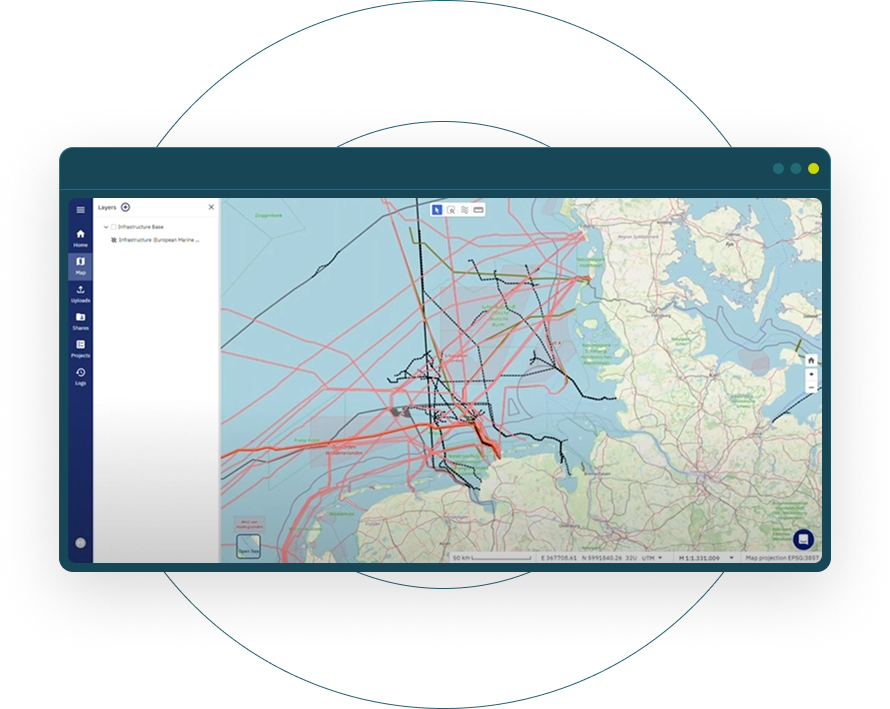
From logging in to exploring 3D sonar data and sharing files, watch how fast your workflow can be.
Explore Our Ocean Big Data Platform
with a first discovery call
Go beyond traditional desktop limits when working with geophysical and geospatial data. Discover how managing ocean data in the cloud dramatically reduces costs and speeds up data management workflows.
Broad Format
Support
Seamlessly work with over 40 file types, ranging from Multibeam and Side-scan Sonar to Sub-Bottom Profiler. Our internal use of the cloud-optimised format Apache Parquet enables you for high-performance cloud computing.
Cloud-Optimised Geointelligence
Today’s offshore projects generate hundreds of terabytes of underwater data. Our technology is purpose-built to match the domain's complexity and make raw data understandable.
Custom Development & Integration
Every organisation is unique. That’s why we develop tailored integrations and tools ranging from survey planning, ocean data processing automation, to AI analytics.
Why Offshore Innovation is So Hard – and How to Make It Happen
north.io is a trusted and enjoyable partner to work with. Their platform makes our daily work with geo data much easier and supports our statewide digitalization strategy for managing, visualizing, and distributing geo data.
Tobias Kuring
Deputy Head of IT at Ministry for Energy, Climate, Environment and Nature of Schleswig-Holstein
Cimbria Subsea Services selected north.io's ocean data platform for its great support in survey planning, data management, and quick quality assurance. The platform’s innovative technology and smooth integration enhance the efficiency of our marine survey operations.
Mona Lütjens
PMO at Cimbria Subsea Services
Working with north.io has been a genuinely positive experience. The TrueOcean platform keeps improving in ways that directly support our workflows, and it's clear the team really listens. Your responsiveness and ability to handle large, complex datasets makes a real difference. We look forward to further developing this promising collaboration.
Stephen King
GIS Lead at Flotation Energy Ltd
FAQ
Frequently Asked Questions
What sensor data formats do you support?
We support 40+ formats including MBES (.ALL, .S7K), SSS (.XTF), SBP (.SEGY), point clouds (.LAS, .XYZ), raster/vector (GeoTIFF, SHP).
How does this differ from standard DEM-based workflows?
Yes. We offer both SaaS and fully self-hosted deployments (air-gapped if needed)
Can i use this with existing survey data, or do i need new acquisitions?
Yes. We provide end-to-end encryption, RBAC and compliance with ISO 9001, OGC standards.
How do i get started?
Absolutely. We support API-based integrations, WMS / WFS and offer custom connector development.